The Center for Urban Research at City University of New York is working with a coalition of civil rights groups, philanthropic foundations, and others to map “hard to count” communities in advance of the 2020 Census. The maps will help organizations to highlight the importance of having Congress fully fund the Census Bureau leading up to the 2020 Census, and to help “Get out the Count” campaigns prior to Census Day in April 2020.
Click here to see the informative, interactive map now.
Click here to read a two-page summary that describes the maps, how you can use them, and other resources for advocates supporting the 2020 Census.
Map Shows Hard To Count Areas in Central Oklahoma
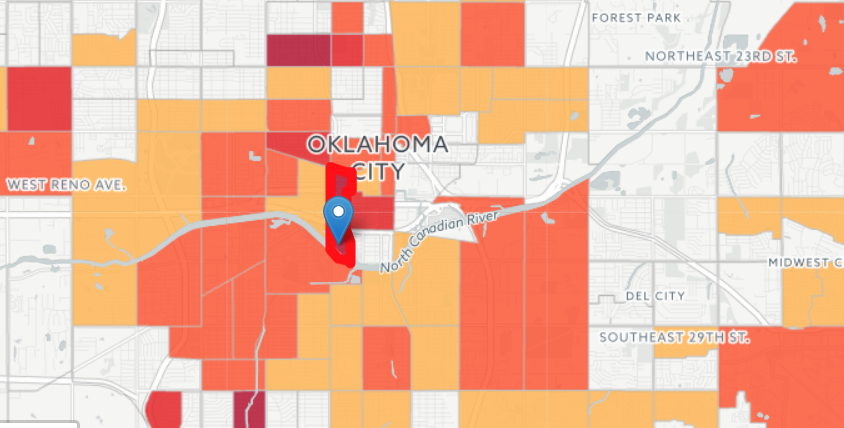
In 2010, only 30.4 percent households in 1036.02 tract in Oklahoma County mailed back their 2010 census questionnaire, requiring more costly and difficult in-person follow up to count the remaining 69.6 oercent. This tract is one of the hardest to count in the country.
Other hard-to-count in Central Oklahoma include the following tracts:
- Pennsylvania Avenue to Western Avenue between NW 30th and NW 23rd Streets
- Linwood Boulevard between South Western and South Shartel Avenues (roughly)
- Villa and Pennsylvania Avenues between SW 44th and SW 59th Streets
- Tract 2012.01 in Cleveland County, which is located in Norman roughly between Constitution and Boyd between Jenkins Avenue and Classen Boulevard
- Stratford Drive to Pennsylvania Avenue between 122nd and Memorial Avenue
- Tract 1082.07 in Edmond Between East Ayers and East 2nd Streets roughly between Bigbee Drive and Bryant Avenue.
You can use the map to:
Search by Congressional district or state legislative district
You can zoom to any district in the country and the map will highlight the hard-to-count tracts within the district and show how much of the district’s population lives in hard-to-count neighborhoods.
Enhance your educational campaign supporting an adequate Census budget
When you search for a district, the information panel to the left of the map provides contacts for each congressional & state representative and US Senator.
Zoom in on any tract in the nation to see its hard-to-count profile
The map color-shades the hardest-to-count tracts in the country. You can click on or tap any tract (or search by address) to find out important population information, such as:
- How many households mailed back their census questionnaire in 2010 (i.e., how much of the tract may require more costly in-person follow up by the Census Bureau in 2020);
- How much of the tract is populated by groups that are at risk of being undercounted, such as children under 5, households with poor Internet access, recent immigrants, and more.