Snow Route Map for OKC Region
Navigate the Snow
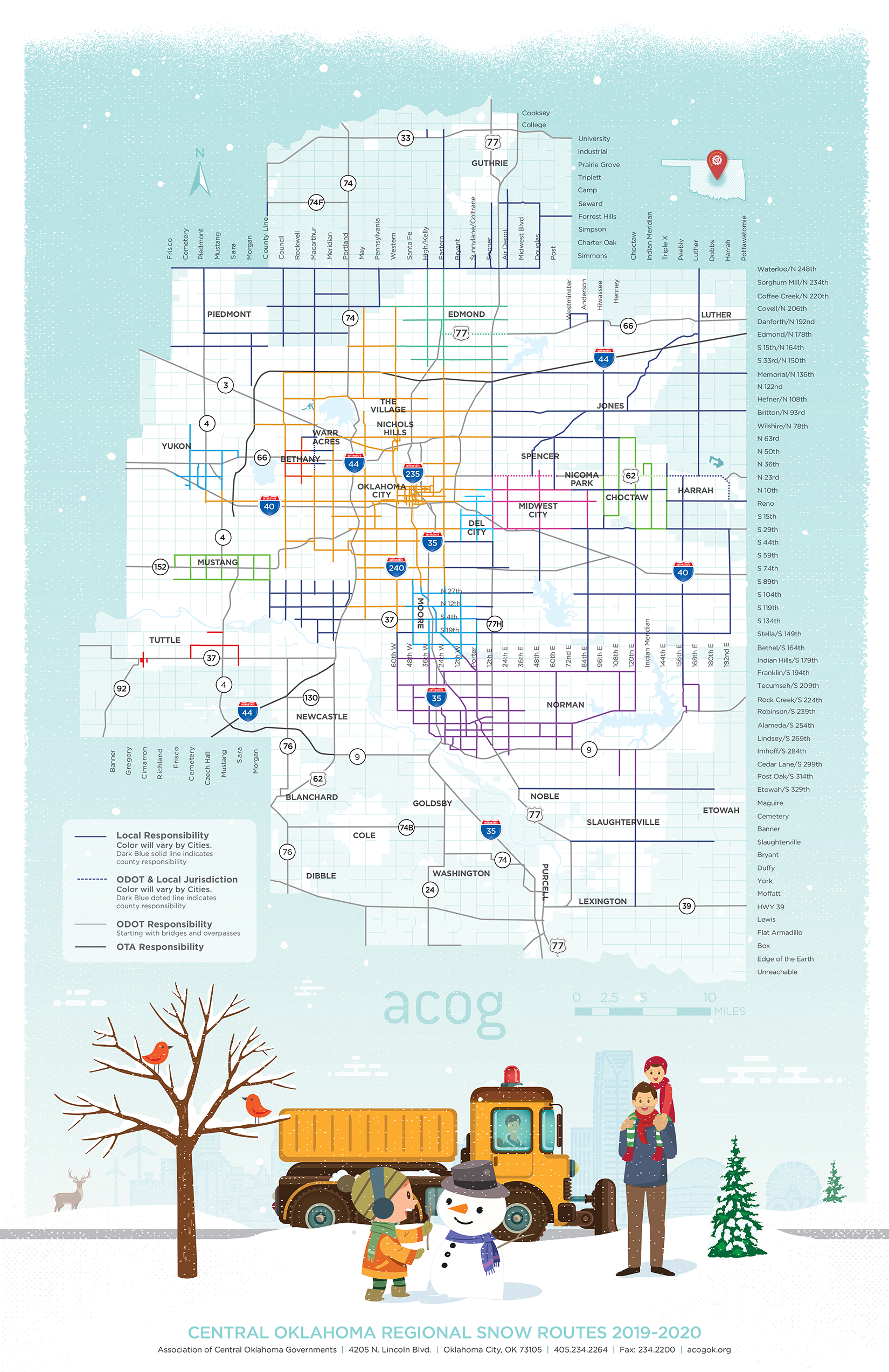
ACOG recently completed updating the 2019-2020 Regional Snow Route Map to provide a useful tool for navigating Central Oklahoma roadways when they are covered in snow. The above map features snow routes for different cities in different colors. Scroll down to see the same map with all routes in red.
First developed in 2007, the Regional Snow Routes system assists in the coordination of ice and snow removal to increase safety for all citizens and travelers throughout the Oklahoma City region, including emergency vehicles, school buses, public transportation and commercial vehicle traffic. It is part of ACOG’s ongoing congestion management efforts.
More than 30 local governments reviewed the map to determine priority snow and ice removal routes within their respective jurisdictions. The Regional Snow Routes ensure a coordinated system among multiple cities and counties so traffic flow is maintained and snow plows have unimpeded access to roadways.\
If you have concerns, comments or questions about the designated snow routes in your area, please contact your local planning or public works office. For more information about the Regional Snow Routes map, you can read the Regional Snow and Ice Management Memorandum of Understanding for the Oklahoma City Area Regional Transportation Study (OCARTS) Area or contact Jennifer Sebesta, TPS Manager, ACOG, (405) 234-2264.
Click to Open
Right Click to Print